Welcome To My Blog
blog
GIS
QGIS
Grass GIS
Disaster
This post will be updated once new post is made. Welcome to my website! Hope you will like the posts.
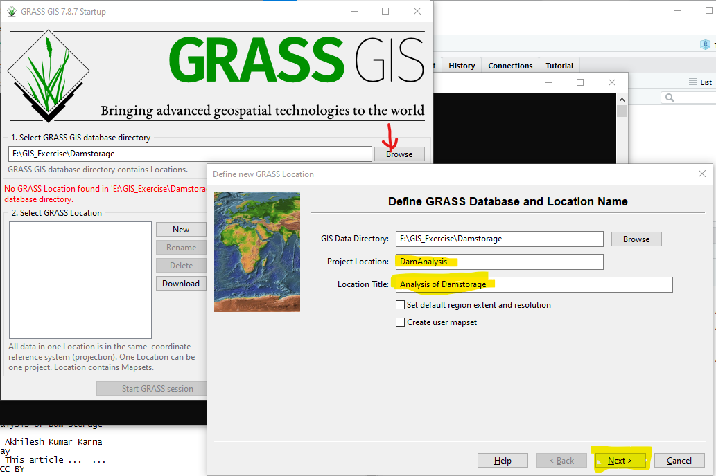
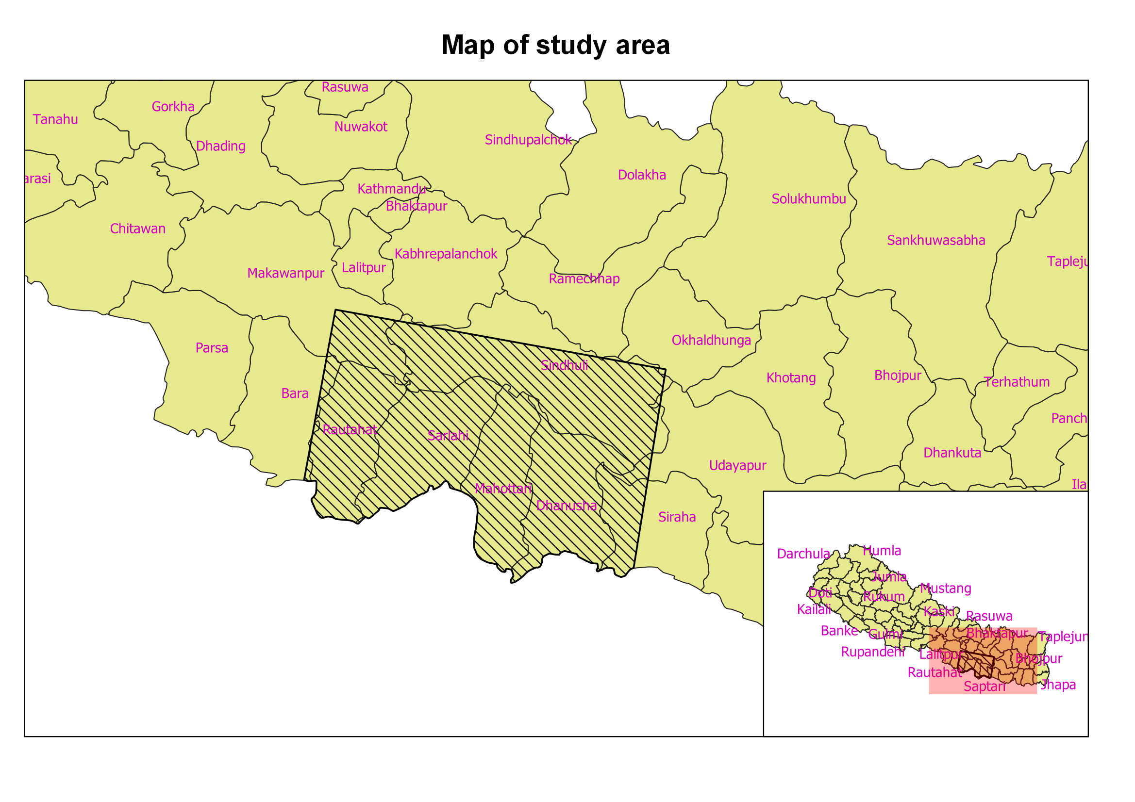
Analysis of Dam Storage
QGIS
Grass-GIS
Elevation
Water
Dam Storage
This tutorial is intended to learn how to calculate the dam storage area and volume based on the dam height. It…
Covid Maps
QGIS
Fiona
Covid
Graph
Map
The map was created using QGIS and python module fiona. The code will be shared on request.
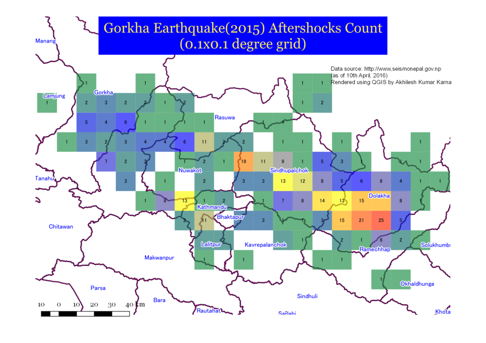
Landslide Susceptibility Analysis using Grass GIS
Landslide
Susceptibility
Grass-GIS
QGIS
GIS
This tutorial has two purposes:
USGS Corona Images of Kathmandu Valley
Landslide
Susceptibility
Grass-GIS
QGIS
GIS
The image overlay map was created by georeferencing the images downloaded from USGS website at this link.
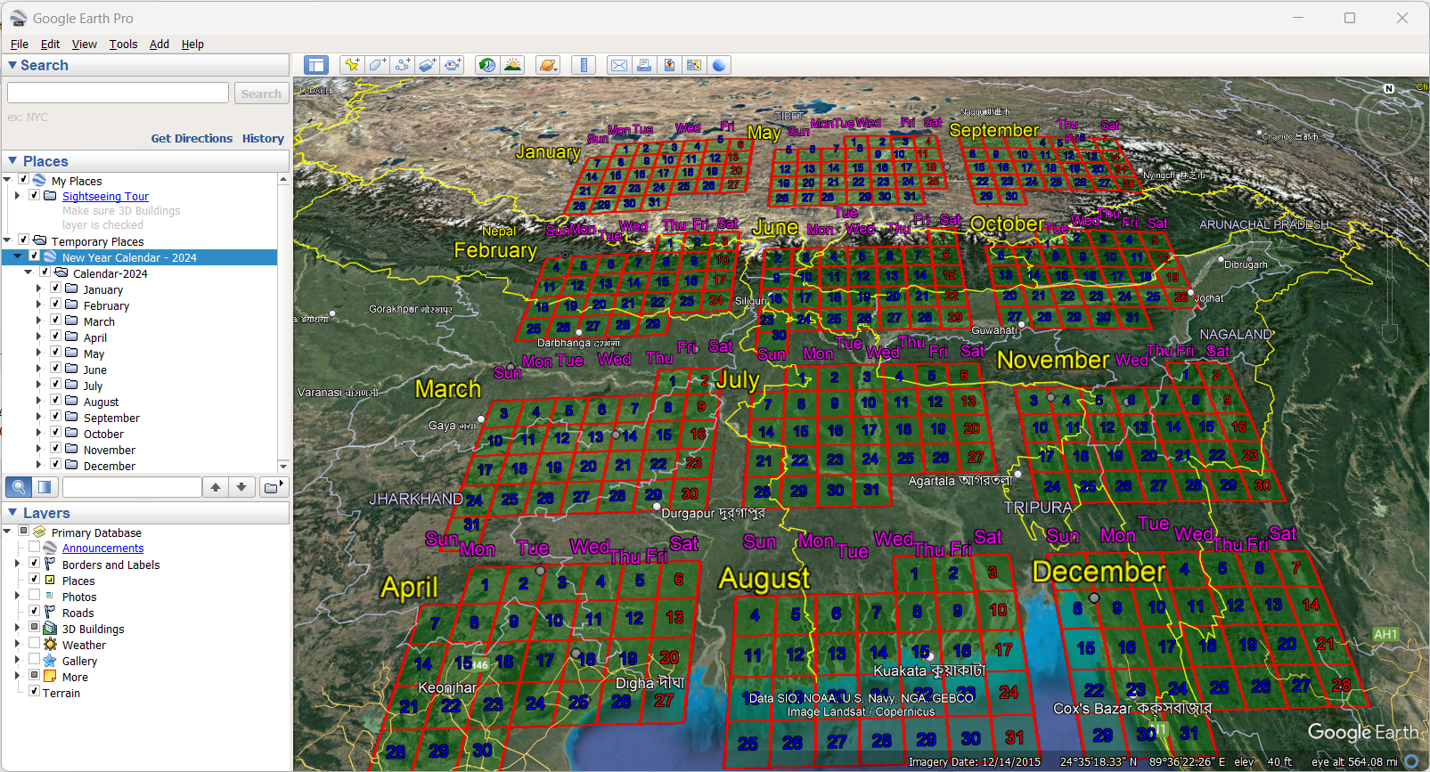
Virtual World Tour in Google Earth
Google Earth
KMZ
Distance Analysis
Flight
Download the kmz file and fly to all the cities in the world! Link is below:
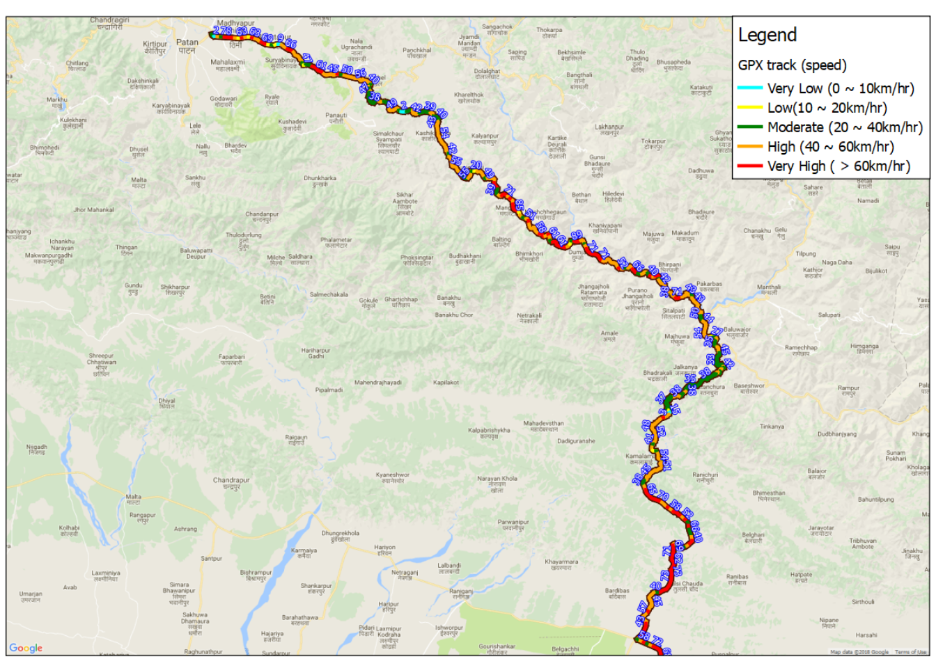

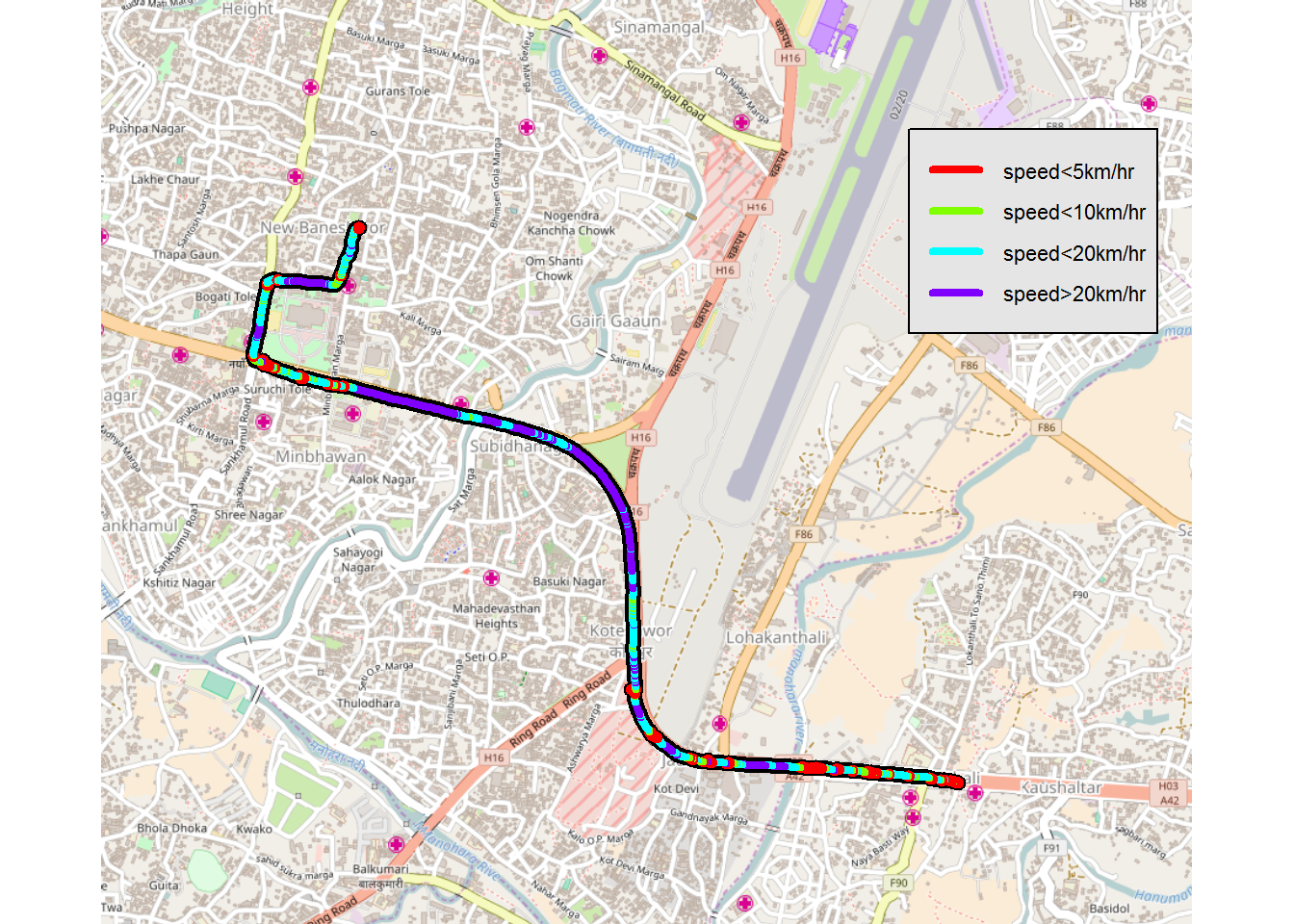
Altitude of Bardibas Sindhuli Dhulikhel Road
QGIS
GPS
Track
Elevation
Altitude
GPS track data using smartphone - OSMTracker app. The track-point-data was converted to gpkg.

Listening Test Android App
Android
listening
kids
java
tutorial
Sometimes you need very simple app to perform a task. But when you look for what…
No matching items